Consultation
This year, the CoastRI team engaged extensively with stakeholders across the entire coastal observation value chain. Through workshops, conferences, and both face-to-face and online meetings, we consulted with research users, federal, state, and local governments, industry operators, and First Nations representatives. These consultations aimed to:
- Identify common data and information gaps
- Discover new data streams
- Highlight areas of need
- Explore opportunities to enhance or leverage existing programs and products
We are grateful for the opportunity to discuss CoastRI with such a broad community and to facilitate conversations about priorities, needs, gaps, and opportunities for collaboration and co-investment.
Key events where CoastRI was represented:
- Australian Coast and Ports Conference
- Australian Coastal Council Conference
- Australian Meteorological and Oceanographic Society Conference
- PIANC Asia Pacific Conference
- First Nations Land and Water Management Forum
- Australian Sea Country Conference
- Australian Mangrove and Saltmarsh Network Conference
These discussions are helping shape an initiative tailored to meet community needs and deliver meaningful societal benefits.
Initial funding
The CoastRI initiative has secured a multi-year investment (2023–2027) to establish its vision, showcase its potential, and attract additional co-investment. This funding supports essential activities in observation, data collection, management, and modelling, addressing critical gaps identified through previous consultations.
Project – Coastal Ocean Modelling Commons
This two-year pilot program, led by ACCESS-NRI, AuScope, and NCI, aims to establish a Coastal Ocean Modelling Commons and enhance Australia’s ice sheet modelling capabilities.
Ice sheet modelling update:
- The Ice Sheet and Sea-level System Model (ISSM) was selected as the officially supported ACCESS community ice sheet model.
- Establishment of the ACCESS-NRI Ice Sheet Modelling team in July 2024.
- The team began developing a range of open-source ISSM tools and workflows, including:ISSM Python API for model pre-processing, configuration and output analysis/visualisation.ISSM Community Cookbook providing the community with ‘ready-to-run’ ISSM modelling and analysis recipes.ACCESS-NRI supported community ISSM Gadi configurations Creation of an open community Ice Sheet Modelling Data pool / Intake catalogue containing both input and ice sheet model output data.
Coastal ocean modelling commons update:
- The ACCESS-NRI regional and coastal ocean modelling team was established in September 2024.
- This team aims to support the ANCOMS (Australian National Coastal Ocean Modelling System) community by developing tools to streamline workflows and address gaps in Australian coastal water modelling.
- Initial discussions are underway with key stakeholders, including modelling teams from CSIRO, various university groups, the 21st Century Weather Centre of Excellence, NCAR (National Centre for Atmospheric Research), and the COSIMA (Consortium for Ocean-Sea Ice Modelling in Australia) community.
Project – Shoreline Observing
This project, led by IMOS, TERN, and AuScope, advances coastal monitoring through the use of drones and fixed infrastructure such as LiDAR and cameras. These tools enable innovative approaches for change detection and monitoring at sites of strategic importance, including validation locations, areas affected by extreme events or inundation, and regions undergoing key coastal management interventions.
- A national workshop was held in March earlier this year to identify current efforts and understand national needs and gaps, with the aim of informing the work plans for a nationally coordinated coastal drone and fixed station program.
- Head agreements are at the final signing phase with facility leads from the University of Queensland, the University of New South Wales and Deakin University, with the program expecting to roll out early 2025.
Project – Monitoring Sea Level Impacts on Coastal Ecosystems Resilience
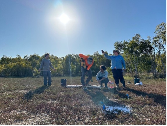
Led by TERN, the OzSET network benchmarks and monitors wetland sediment elevation changes across 31 locations using Surface Elevation Tables (SET). Integration of drone-based remote sensing and LiDAR with SET measures aims to provide a comprehensive view of wetland vegetation characteristics.
OzSET update:
- The project officially launched with Senior Project Coordinators Madeline Goddard and Vicki Bennion. Learn more about OzSET here.
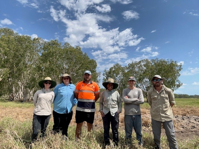
- The network expanded with 15 new SET installations at Mungalla Station, achieved in collaboration with Traditional Owners and CSIRO.
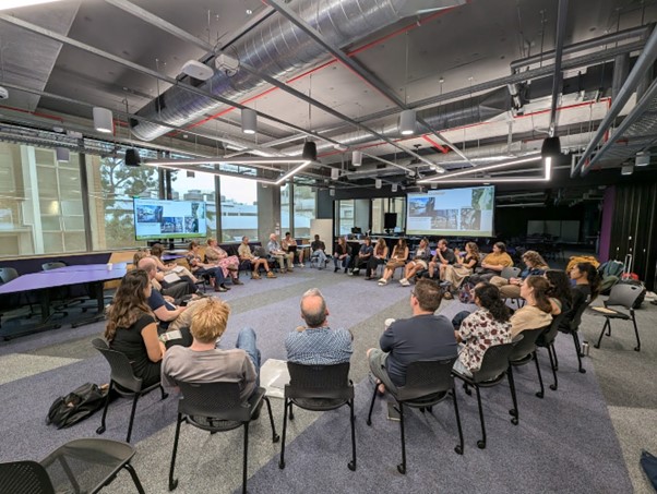
- OzSET hosted a workshop at the Australian Mangrove and Saltmarsh Network Conference, gathering insights to inform the future direction of the OzSET network.
Project – Coastal Waves and Estuarine Condition
Led by IMOS, this project is developing observing capabilities to monitor coastal waves and physical dynamics and water properties at estuary entrances to improve understanding of processes and conditions linked to inundation and other coastal risks. These platforms will provide essential baseline data to understand conditions and trends in key coastal areas.
Coastal Wave Buoy update:
- Establishment of the IMOS Coastal Wave Buoys Facility (IMOS CWB).
- The IMOS CWB is based at the University of Western Australia (UWA), with regional sub-facilities managed by Deakin University (VIC), SARDI and Flinders University (SA), the New South Wales Dept. of Climate Change, Energy, the Environment and Water and University of Newcastle (NSW), and AIMS and the Queensland Dept. of Environment, Science and Innovation (NT and QLD).
- The IMOS CWB network consists of 23 sites across Australia, supported through a combination of IMOS funding and regional partner co-investment.
- A dedicated data officer has commenced at UWA, and deployments are underway.
- Currently, 10 sites are deployed, with the remaining sites scheduled for deployment in the first half of 2025.
- Near real-time data is available via the IMOS AODN (Australian Ocean Data Network) as part of the ‘Wave buoys Observations – Australia – near-real time’ dataset, with spectral data planned to be available in near real-time in 2025. All delayed mode data will be part of AODN’s National Wave Archive and will include integrated wave parameters, spectral wave parameters, and raw displacement timeseries.
Estuarine Moorings update:
- A horizon scan of existing National Infrastructure for estuarine and coastal moorings has been completed, and design options for national rollout are currently under consideration.
- IMOS is currently working with stakeholders and rights holders to identify key priority areas for infrastructure rollout, and discussions are underway to identify a host institution to lead the facility.
Full program
In August, the CoastRI consortium successfully completed the full program description, comprising seven key work packages and two cross-cutting themes. This program has been formally endorsed by all 13 NCRIS partners and reviewed by an independent Science Advisory Committee and Advisory Board. The description was submitted to NCRIS in August for consideration as part of the step-change funding processes.
While the timeline for a funding decision remains uncertain, we are committed to keeping the community updated on any progress.
Looking Ahead to 2025
Your support has been invaluable in driving the progress of CoastRI. As we enter 2025, we’re eager to build on this year’s accomplishments and further explore opportunities for collaboration, value-adding, co-investment, and co-design.
If CoastRI receives funding, our first steps will involve organizing a series of workshops that bring together researchers, stakeholders, and Indigenous representatives. These workshops will serve as a collaborative platform to refine the program’s implementation—focusing on identifying key activities and equipment, selecting optimal deployment locations, defining data standards, and exploring co-delivery and co-investment opportunities.
While our consultation efforts to date have concentrated on understanding stakeholder priorities, the next phase will shift toward designing a step-change program. This approach will leverage the expertise of researchers, stakeholders, and First Nations to ensure a comprehensive and inclusive framework.
Thank you for being an integral part of the CoastRI journey. We’re excited to continue working with you in the year ahead.
Get in touch
If you have any questions, want to contribute, or are interested in co-investment and co-delivery opportunities, please get in touch with us.
Rebecca Zitoun, Science Coordinator, [email protected]
Daniel Ierodiaconou, Lead Scientist, [email protected]
